We Energies Gas Laterals
GIS, Planning, Power & Energy, Survey | Wisconsin | Back

Challenge
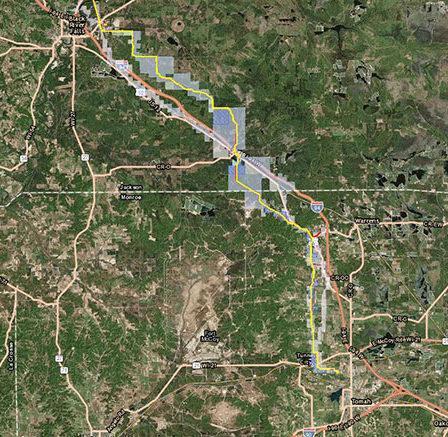
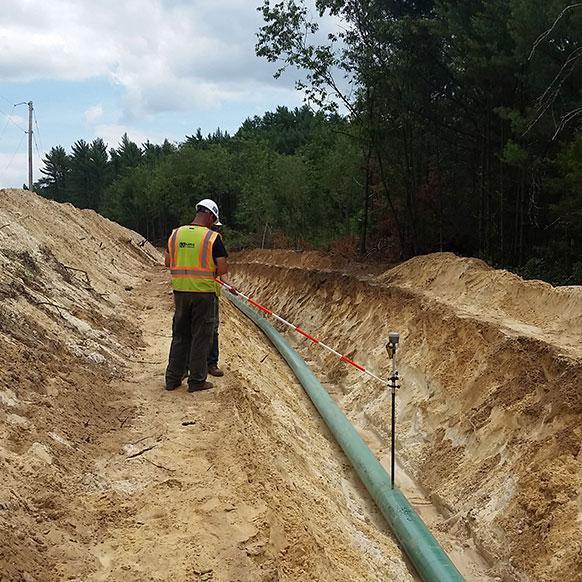
Kapur won the design and survey contract for three separate laterals in Northwest Wisconsin. As part of the design solution, Kapur developed a GIS system for the 110-mile route of the new Western Lateral Pipeline. The three lateral projects include the North West Capacity project, the Blair Lateral project, and the Sparta Lateral project.
The scope for these projects was to deliver aerial photography, 1-foot contour maps, utility locates, and right-of-way boundary determination for a 600-foot-wide corridor for the length of the project.
Solution
Kapur was responsible for organizing project-related data into a GIS and analyzing derived data to assist We Energies as needed. This includes the development of early easement exhibits, exhibits for public involvement and website use, final easement exhibits after they have an approved route, and tracking properties for right-of-way, acquisitions, and easement completion.
The mobile application we developed for the site allows our staff surveyors to pinpoint their location in the field relative to other project-related GIS data. One key feature of the site highlights both participating and non-participating properties. This helps surveyors in the field know which properties they are allowed access to.
Services Provided
- Field survey
- GIS
- Gas design
- Construction staking and layout
Industries Covered
- Survey
- Planning
- GIS
- Power & Energy
Results
Kapur developed a website enabling staff to upload easement exhibits online to be viewed by the project team. This website allowed for online review and revision to happen in real-time and tracked notes for all revisions. The developed workflows also allow team members to visually inspect the percentage of easement exhibit completion, making it easier to determine which project areas to proceed with to ensure efficient progress.